|
|
 |
|||||||||
|
||||||||||
|
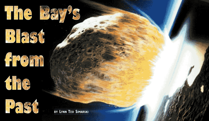
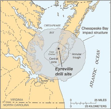
A great extraterrestrial object predetermined the Chesapeake 35 million years ago.When the space rock struck 35 million years ago, there was no Chesapeake Bay, no Western or Eastern Shore. Where the lower Bay is today, the Atlantic Ocean sloped gently seaward from a shoreline about where Richmond is now. A tropical climate steamier than modern summers reigned over forests and swamps rank with rotting vegetation. Up in the trees, lemur-like primates munched fruit and leaves. Down below, giant flightless birds stalked tiny primitive horses. In the ocean, life was more similar to now, with clams, sea urchins, fish, sharks and early whales. Into this time and place came a strike from space without warning. A meteor two miles across hurtled in through the atmosphere, slamming into the waters and the rocks of the continental shelf. Ground zero — the center of the largest space impact in the entire United States — was about where the city of Cape Charles, Virginia, now lies. Today, the wreckage of that strike is entombed more than a mile down in the earth. But the effects of the cosmic cataclysm still reverberate for those who live in the Chesapeake watershed, whether they know it or not. The impact stamped the rocks with a pattern that helped to guide — many millions of years later — the eventual location of Chesapeake Bay. It pulverized rocks harboring the region’s deep groundwater, affecting even now how people get their water on both sides of the Bay. The great object plummeted to Earth at over 40,000 miles per hour. Air, water and rock — as well as all creatures, from microscopic to whale-sized, unfortunate enough to have been living at the site — were compressed instantly into a gaseous plasma, which then exploded. The force of the impact was 100 times greater than the combined power of all today’s nuclear weapons. The blast made a giant, temporary hole in the water — and a more enduring cavity 24 miles wide through the sediments and into the harder basement rock of the ocean floor. Debris shot skyward, then dropped back in. Giant tsunami waves surged outward in all directions, quite possibly to the top of the Blue Ridge Mountains, and all the way to Europe and back. The cavity walls rebounded, collapsed and slumped inward, leaving a crater shaped like a flipped sombrero sitting on its top, with a brim 53 miles wide. The impact left the Earth fractured six to 12 miles down. “The blast wave alone would have instantly incinerated all higher life forms within 600 miles of the impact site,” writes geologist Wylie Poag in his book, Chesapeake Invader. Such an impact today would kill tens of millions of people and destroy Baltimore, Washington and other large cities on the East Coast. But no human being was there to watch, those millions of years ago in the time called Eocene, as the waters of the Atlantic closed once again over the site of the cataclysm. No one was there, either, to report if the space object was a rocky asteroid or an icy comet. So far no fragments with telltale chemistry have been found. No undisturbed Eocene rocks remain in the area, so we can only conjecture, based on fossils from elsewhere, what lived at the strike site. Soon after the impact, ocean sediments began to blanket the enormous scar — preserving it for the day when scientists would at last drill its depths and read the violent saga. A Thirsty Discovery
|

 |
Scientists from eight countries came to survey headquarters in Reston to examine the miles of samples taken from the core. |
Meanwhile, over the 1960s and 1970s, a rain of miniscule glass added evidence for an impact. Tiny balls and teardrops of glass, no larger than an inch or so, were found scattered from the western North Atlantic to Texas and the Caribbean. They turned up in rocks on the seafloor as well as on land. These dark pearls of molten rock showed, by their shapes, that they had been thrown into the air, then cooled into glass called tektites. The region harboring the glass, dubbed the North American tektite strewnfield, is one of four known in the world.
“If you have a strewnfield, you need a crater to go with it,” says geologist Greg Gohn, who heads the crater research project at the Geological Survey.
All the while, geologists looking for water and surveying rocks in lower Virginia and offshore continued to find puzzling rocks containing microfossils of different ages mixed together in their drilled cores. But their cores were like so many pinpricks. A bigger picture was needed: a scan of the inner earth.
Such pictures, called seismic reflections, actually existed, produced by oil companies using the same principle that ultrasound employs to image a child in the womb. The enormous scale of buried rock structures, however, requires a much bigger noise to image. Geologists set off explosions to spawn sound waves, which travel through the Earth, then return to surface receivers. The waves bounce off the boundaries between rock layers, enabling a picture of the rock structure.
It took years of asking by Geological Survey geologist David Powars, but in 1993 he convinced Texaco to release seismic pictures of the Earth’s structure around the lower Bay.
“The most tangible aha! moment was when we got seismic profiles from Texaco,” recalled Poag, who also worked on the research. “We could see this big hole. I knew right away what it was.”
The crater’s discovery, like most of modern science, was far more than the work of a single person. As Geological Survey’s Wright Horton says of how geologists are lured to such a dramatic chapter of Earth history, “We all sort of fall into the crater.”
By the early 1990s, teams of scientists including Poag and Powars were weaving together seemingly disparate evidence into a compelling explanation. The salty groundwater, the jumbled rock, the glassy rain and the seismic pictures all added up to a cosmic impact. It was time to drill deep down into what they now knew was an impact crater.
Life at the ExtremeTough and tiny creatures have been turning up over the past decade or so in the most extreme environments on Earth. Extremophiles, as these microscopic animals are known, have been found in the deep mines of South Africa, the boiling springs of the ocean floor and in a lake buried beneath more than a mile of Antarctic ice. Now practitioners of extreme biology are looking for life in the core drilled out of the Chesapeake impact crater. The very slow flow of groundwater through the impact area, plus other evidence such as computer simulations, suggests that the pores of deep rock might well contain very old water, perhaps dating from the time of impact itself. Microbes might even be living in the water — life that has been isolated from the surface for over 30 million years. “Microbes are even better than cockroaches at surviving,” says Mary Voytek, a microbiologist with the U.S. Geologic Survey, who is searching for life in the core. The impact wiped out all life where it hit, creating what Voytek calls “a massive sterilization event.” As water moved back into the crater and the heat of the explosion dissipated, microbes also began to return. The act of drilling itself — pushing a piece of turning metal from the surface deep into the hole — carries a risk of contaminating the rock sample with modern microbes. The drillers guarded against this by adding fluorescent tracers to the coring barrel, which would highlight any contamination when samples were viewed later under the microscope. As drill core was brought up, pieces were carved off and frozen separately for later study. So far, however, laboratory attempts to coax microbes to grow from the rock samples have not succeeded. The crater could hold other lessons, as odd as it sounds, as a cradle of life. Biologists are interested in how organisms might have survived on Earth when the planet was young and mostly inhospitable to life. Impacts from space have caused huge extinctions throughout Earth’s history, but they might also have created hot and wet environments in deep rocks that could have nurtured life. “After Earth became a planet, maybe those bombardments provided refuge for life,” Voytek says. She and her colleagues are studying just what kind of cell it would take to survive, even thrive, in such conditions. Studies of extreme life don’t stop at Earth. Crater geologists are eyeing circular depressions on Mars that look similar in shape to the Chesapeake crater. They believe that life-nurturing habitats created by meteorite impacts could have existed on other planets such as Mars. — Lynn Teo Simarski |
Rock Around the Clock
To plumb the depths of the crater, scientists descended upon a soybean field in Eyreville, Virginia, not far from the town of Cape Charles (see sidebar). Drilling began in the summer of 2005 and continued 24 hours a day, seven days a week, stopping only when the drill jammed in sticky, swelling clays, forcing the drillers to move to a new hole.
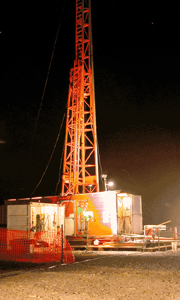 |
With the character of the rock changing from sand to clay to hard rock, and back, no single bit worked for the drilling rig. |
Today, Geological Survey micropaleontologist Lucy Edwards, who spent long hours at the drill site, fingers a drill bit that glitters with worn diamond studs. Her real gems are the distorted and contorted fossils found in the core and what they reveal about the environment in which they were deposited. During drilling, she recalls, no single drill bit was right for the job, since the character of the rock changed constantly from sand to clay to hard rock, and back.
At 3,600 feet, the crew ran into another obstacle, more administrative than technical. The drill began to bring up hard, pink granite, rock that yielded to drilling but seemed to have no end. Speculation grew that the drill had reached the crater floor. As weeks went by and only granite came up, “it got ugly,” Powars recalls. Pressure grew from headquarters to end the work. “There were arguments hourly to stop the drilling,” he says.
Meanwhile, when Powars and his colleague Wright Horton did sleep, both had dreams that the drilling was “coming into sand.” Finally, after three weeks and 900 feet of the crystalline rock, the drill bit broke through at last into unconsolidated sand. The obstinate granite, it turned out, had not been the crater floor at all; rather, it was a huge block that had collapsed in after the impact during an enormous landslide from the crater wall.
Rock and Roll: Sampling the Core
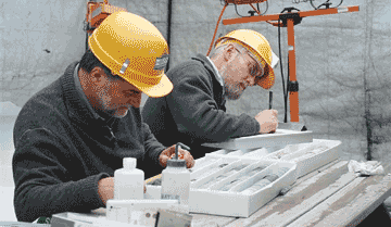
The drilling, concluded last spring, produced one of the most complete cores ever extracted from an impact structure. The end of the drilling, as Horton put it, heralded the beginning of the science. In March 2006, geologists at survey headquarters in Reston painstakingly lined up the entire core — a mile of samples — on tables set up in the cavernous space of an old print shop. Then they threw a sampling party for scientists from eight countries.
Like Victorian suitors leaving calling cards in the vestibules of their intended, the scientists placed namecards at the rod of core they wanted to sample for study. No one asked for a piece of the geological wallflower, which not surprisingly, was the granite. So popular, however, was the transition section from impact to aftermath that there was not enough of this sample to go around.
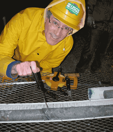 |
Wright Horton washes a section of core sample. |
Today, the core resides at the Reston campus in a hillside repository of almost crypt-like aura. Under institutional lighting, drawer upon drawer opens to reveal thin rods of rock in orderly cadence. Pinks, greens and grays, swirls and waves — the rock is beautiful in an abstract way.
On the one hand, says Horton, using cores of rock to envision the massive crater and the processes it records “is like looking down through a drinking straw.” But the impact itself has served geologists as a sampling tool, excavating from the depths a huge amount of rock that otherwise would never have been seen, and depositing it at a higher level where it could be cored.
The rock core is as close as anyone will ever get to touching the great Chesapeake crater, which lies far beneath sediments deposited for millions of years after the impact. Still, some modern landscape features do speak in subtle terms of what lies below. Sag and settling of rock, within the crater basin “predetermined” the location of the lower Bay itself, Poag believes.
There are other clues: A couple of ridges on land, on both the eastern and western sides of the Bay, arch around to follow the crater rim beneath. And the York and the James rivers both make abrupt dog-legs northeast before emptying into the Bay — turns that correspond to where they cross the crater rim deep beneath.
Drilling Deep through Time in a Soybean FieldNo monument commemorates the spot where geologists drilled down into the center of the crater left by a cosmic object slamming into the earth 35 million years ago. Today it looks like a gravel parking lot sitting in the corner of a soybean field. With drilling in full swing in the fall of 2005, however, the scene was jumping. The drill rig was running 24 hours a day, every day. That did not bother farm owner Roger Buyrn, who didn’t want it to end. He was thrilled to meet researchers from around the world and to learn from each one. He visited the site daily, eager to help and to watch pieces of geologic history come to light that no one had seen before. Buyrn has lived on the farm, a few miles from Cape Charles, for 20 years. “Who knew that the deepest part of the impact was under us?” he marvels. Neither the constant noise of the drill rig nor the nightly glow in the sky disturbed Buyrn, whose house is about half a mile from the drill site. “I hated to see them leave,” he says today. Other landowners chided him for letting the land be used for scientific drilling that would bring him no profit. Buyrn’s answer: “It may benefit all of humanity.” Land ownership brings responsibility for the property in your stewardship, he says. Buyrn credits his father with instilling in him a love of learning, and he welcomed researchers to his farm even before the drilling project. Scientists installed wells on his property to study nitrate contamination of groundwater. Others cored trees to study forest and climate history. Of everyone he met, one scientist has stood out to Buyrn for sheer drive, energy and an ability to make friends with local residents: U.S. Geological Survey crater geologist David Powars. Before the drilling project, the talkative and hyperkinetic Powars had run seismic lines through the area, which required convincing landowners to cooperate. “I love him to death,” Buyrn says, “but his secret — he didn’t know it — was that people agreed just to shut him up.” During the project, even a dog someone abandoned on the farm adopted the drillers. The pointer named Gunner the Drill Dog took up residence at the drill site and had puppies in the drill shed about halfway through the project, Buyrn recalls. Project members adopted all the puppies and even claimed the mother. When the project money ran out, the drillers had to stop. They offered to restore the soybean field to pre-drilling condition. Buyrn wouldn’t hear of it. “There are hundreds of tons of stone still there, and it’s going to stay there, in the event they want to return,” he says. Buyrn was presented with the tattered American flag that flew on the drill rig. It sits in his barn, awaiting possible donation to a Chesapeake crater museum now under discussion. — Lynn Teo Simarski |
Impacts Coming to a Planet Near You
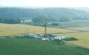 |
Roger Buyrn’s farm oustide Cape Charles, Virginia, where the core project took place. |
The Chesapeake crater seems rare and cataclysmic to us on a human scale, but it has company. More than 170 craters are known on Earth, and many more pockmark other bodies in our solar system.
In North America, only one crater surpasses the Chesapeake’s in size: Chicxulub in the Yucatan, formed 65 million years ago by the blast believed to have wiped out the dinosaurs. There is no evidence of mass extinctions resulting from the Chesapeake impact, however.
Intriguingly, another crater — Popigai in Russia — dates from around the time of the Chesapeake impact. Multiple craters created at the same time bring to mind a modern analog — the string of icy balls from fragmented Comet Shoemaker-Levy 9 that hit the planet Jupiter in 1994. But the Chesapeake and Popigai are not quite contemporaneous, as Wylie Poag explains. The Russian impact seems to be 10,000 to 20,000 years older than the Chesapeake, so both could not have been created by pieces of the same extraterrestrial object. Still, the two just might have been part of the same meteor shower.
From the perspective of deep time, the long periscope through which a geologist peers, impacts from space are a normal event in the corner of the universe we inhabit. In the United States, Arizona’s Meteor Crater was created about 50,000 years ago, well after human beings appeared on the planet. But it is only a little over a half-mile in diameter — nowhere near the scale of the Chesapeake crater. For the record, scientists have calculated that a U.S. resident has a chance of about one in 20,000 of dying from a cosmic impact. That’s 200 times less likely than dying in a car accident.
Still, “It’s one of the most basic geologic processes that occur in the solar system,” Poag says. “It’s pretty clear there will be more in the future.”
A former National Science Foundation writer now cruising the Chesapeake in all seasons, Lynn Teo Simarski coauthors a new monthly column, Voyage of Discovery, in Bay Weekly.